The main responsibilities of the Hellenic Navy Hydrographic Service (HNHS) are to:
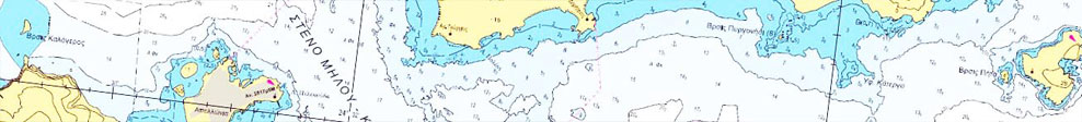
- study, prepare, publish and distribute nautical charts and publications and aids in printed or electronic format, catering to the needs of seafarers and the operational requirements of the Hellenic Navy (HN) and the Armed Forces in general.
- provide to the HN and the Armed Forces (AF) in general, the environmental support data and information necessary to conduct their maritime operations.
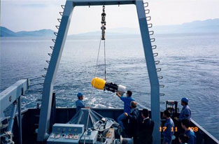
 conduct oceanographic, cartographic and maritime works and studies and put in place research programs to collect data and information required to create products related to supporting the HN and meeting the needs of military and other agencies.
- study, prepare, publish and distribute specific thematic charts to support the needs of the HN, the Ministry of Foreign Affairs and other government agencies in matters of maritime law.
- issue notices and navigational warnings, with a view to informing seafarers on matters affecting navigation safety.
- issue NAVTEX messages related to maritime safety, being the national coordinator of the system, in cooperation with the Ministry of Shipping, the National Meteorological Service, the Hellenic Telecommunications Organization (OTE) and other competent bodies.
- install, operate and monitor the sea level measurement system (National Tide Gauge Network), as well as stations for measuring parameters of various natural phenomena, such as waves, currents, etc, with a view to collecting data to be used to generate products and services related to its mission.
- review, study and issue opinions on matters within its competence, to determine sea routes, channels, straits and natural harbors.
- issue opinions on the type of marking maritime dangers, sea routes and narrow waterways, wind parks, etc., to ensure seafarer safety.
- issue opinions on the feasibility, installation of torches, buoys and navigation radio aids.
- issue opinions on the installation or construction of port or other works on the coastal zone or in the sea.
- offer, for a fee, the products created and services on matters pertaining to hydrographic, cartographic, oceanographic and maritime works and other scientific studies that fall under its competences to agencies other than the HN.
- monitor and promote sciences and arts that relate to Hydrography, Naval Cartography, Shipping and Oceanography, in collaboration, where necessary, with government agencies, educational institutions, scientific institutions and research centers, both domestic and foreign.