A. Hydrographic Measurements
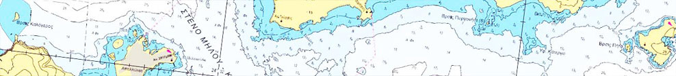
Hydrography is the branch of earth sciences dealing with measuring, describing, and mapping characteristics (natural and artificial) of the relief of the seabed and the surrounding coastal areas.
Investing in Hydrography improves safety at sea, enhances the protection of the marine environment and promotes national growth. This means more efficient and safe maritime transport, leading to the strengthening of global and coastal trade. In addition, it contributes to the development of national infrastructure, coastal zone management, promoting marine research, exploiting marine resources (minerals, fishing, etc.), delimiting maritime borders, sea defense and security, and managing coastal disasters.
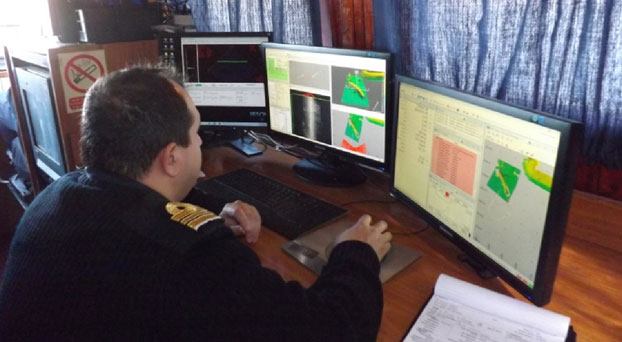
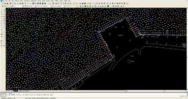
To that end, special vessels are used aboard which is installed the necessary scientific equipment for measuring depth and position, seabed survey, as well as computers with appropriate software for data collection and processing. All works are performed by suitably qualified scientific staff.
It has been established that almost every human activity performed in, on or under the sea requires some knowledge of the hydrography of the area concerned, that is, knowledge of the shape and nature of the bottom, its characteristics and risks. It, therefore, becomes evident that hydrography is necessary for:
- the safe sailing of ships;
- building ports;
- developing coastal infrastructure;
- implementing marine environment projects;
- protecting coasts and islands;
- performing sea rescue operations;
- developing flood models;
- delimiting or respecting maritime borders.
Accordingly, insufficient hydrography means: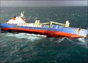
- increased risk of maritime accidents, resulting in loss of life and environmental pollution;
- lack of trust in sea routes and ports, leading to a drop in international trade and wasted economic opportunities;
- environmental impacts;
- possible litigation and legal responsibilities.
Let us consider the cost of:
- underdeveloped ports;
- complex and dangerous sea routes;
- the lack of fundamental design elements for coasts and seas;
- limited area of operations of patrol vessels and warships.
Studies in this area have shown that the cost-benefit ratio is greater than 1:10!
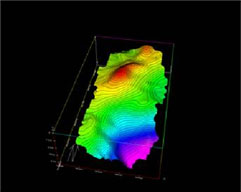
The important work of hydrography has been undertaken by the Division for Hydrography-Operations of the HNHS. It is its core mandate to plan, design and conduct Hydrographic, Geodetic and Topographic fieldwork. Data collected are processed to draw up relevant studies and charts, which are then forwarded to the competent directorates and serve to update navigational charts and nautical publications and disseminate maritime information to end users.
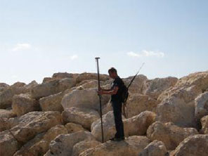
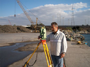
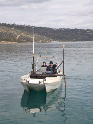
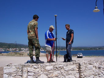
Fieldwork is carried out by Hydrographic Crews made up of qualified scientific, technical military and civilian staff, onboard the vessels available, conducting the necessary geodetic and topographic works.
All works and data processing are performed pursuant to the technical specifications laid down by national legislation and the technical instructions of the International Hydrographic Organization (IHO). Such specifications have been incorporated in the standing Hydrographic Instructions given to the Hydrographic Crews.
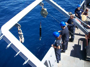
To carry out these works in accordance with the prescribed requirements, the Division has installed suitable equipment aboard its vessels and at its facilities, consisting of:
- Precise positioning systems (Global Navigation Satellite Systems);
- Multi-beam echo-sounders;
- Single-beam echo-sounders;
- Sound velocity profilers;
- Side scan sonars;
- Data collection and processing software;
- Surveying instruments;
- Network of permanent tide gauges;
- Underwater cameras.
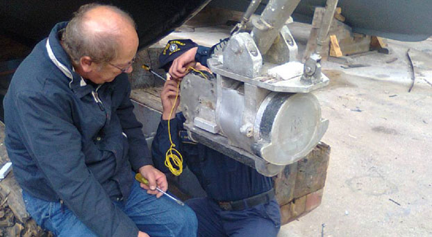
Appropriately qualified technical staff are responsible for repairing and maintaining those instruments to ensure their proper functioning and extend their useful life.
All information obtained from the processing of data, besides being made available to other directorates of the HNHS to produce and update its end products, are kept in printed and electronic format in the Directorate's records for future use.
The Division's staff is also involved in joint surveys with other countries hydrographic offices as part of international agreements and programs in which the HNHS is involved.
In addition to the above, drawing on its expertise and experience, the Division cooperates with other government agencies, such as ministries, regional governments, municipalities, port organizations and authorities. There is particular cooperation with other geographic and scientific agencies, such as the Hellenic Military Geographical Service (HMGS), the Greek Center for Marine Research (HCMR), National Cadastre & Mapping Agency SA (NCMA SA), as well as higher education institutions such as the National Technical University of Athens (NTUA) and the University of the Aegean.
B. Oceanography
Being knowledgeable of the marine environment and how it behaves, plays an important part in the conduct of naval operations. The Hydrographic Service is in charge of planning and conducting oceanographic research to study and find out about the physical parameters and natural phenomena of the marine environment, to the benefit of the HN. It is a set of scientific works, known as Military Oceanography, implementing operational oceanography, with a view to supporting the units of our fleet. Oceanography Directorate is in charge of such tasks.
The instruments used include:
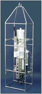
CTD instrument packages
Conductivity, Temperature, Depth (CTD) instruments are used to determine the main physical parameters of the water and the speed of sound propagation in it.
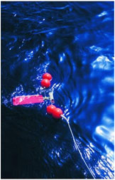
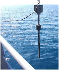
Current Meters
Mechanical and acoustic current meters are used to measure the speed and direction of currents in different regions of the Aegean and Ionian Seas at selected depths.
At the same time wave conditions prevailing in Greece’s maritime space are assessed. These forecasts are intended for use by the Ministry of Merchant Marine for the departure of certain passenger ships. They result from the use of mathematical models to estimate the wave field taking into account the speed and direction of winds in the area of interest.
The Directorate also collects bathythermographic and other observations from other ships and services of the HN. These are processed, sorted and used accordingly.
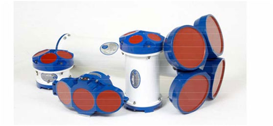 Different Type Acoustic Current Meter
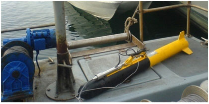
(Side Scan Sonar)
Type 'Chirp' Sub-bottom Profiler
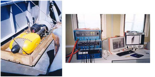
It determines the stratigraphy of the seabed structure to a depth of several meters, depending on the particle size distribution of sediments in the area studied.
 Surface Sediment Samples
It takes disturbed samples of surface sediment. Such samples are analyzed in the laboratory to sort sediments based on their particle size distribution and determine the content of carbonates in them.
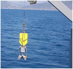
Gravity Core Sampler
It takes samples of bottom sediment cores. The undisturbed samples taken are analyzed in the laboratory to sort sediments based on their particle size distribution across the entire sampling length, as well as to determine the percentage of carbonates, the density and shear strength of core sediments.


