The Directorate for Electronic Navigational Charts organizes, manages and updates the Cartographic Database of HS's Marine Geographic Information System. As part of its activities, the Directorate for Electronic Navigational Charts draws up, updates and makes available:
- Electronic Navigational Charts (ENCs)
- Printed Navigational Charts using digital methods
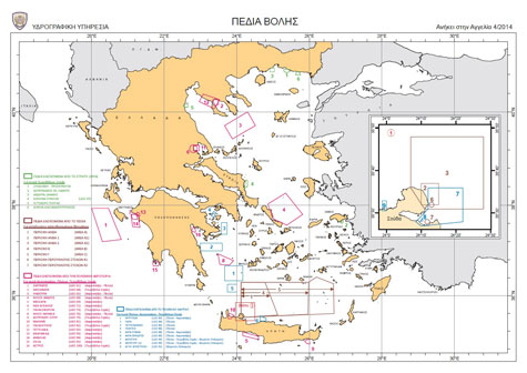
- Additional Military Layers (AMLs)
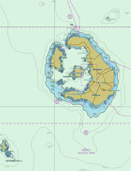
- Thematic Charts
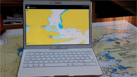
- Digital Nautilus Charts smartphones and tablets
- The Web Map Service
- Marine Geospatial Data
ENCs are VECTOR maps in S-57 format in line with the specifications of the International Hydrographic Organization (IHO). These charts are suitable for Electronic Chart Display Information Systems (ECDISs) and available in IHOS-63 encryption. Greek ENCs can also be used by any system that can read S-63 encrypted S57 data structure.
Since April 2004, the HS has began offering Greek ENCs, as well as the monthly constant Updating Service via the Regional Coordinating Center for IC-ENC Chart Distribution.
Anybody interested in information on the availability, as well as on the conditions that apply to and the way of obtaining Greek ENCs, can visit the IC-ENC website.
For further information or clarifications on issues related to the activities of the Directorate for Electronic Navigational Charts, please call +30 2106551830 and +30 2106551759, or email us at dcd_hnhs@navy.mil.gr